A subglacial flood in Greenland burst upward through tens of meters of ice, pushing up blocks the size of five-story buildings and scouring clear an area nearly twice the size of Central Park in New York City, according to research published in the journal Nature Geoscience .
This occurrence of water fountaining up instead of flowing down along the base of Greenlands ice sheet was extremely surprising, says Winnie Chu, an assistant professor of geophysics at the Georgia Institute of Technology, who was not involved in the paper but studies the countrys ice. Having meltwater basically forcing its way up from the bed, that requires some extremely unique conditions, Chu says.
The event occurred in 2014 near Harder Glacier in far northern Greenlanda spot where a flash flood wouldnt get noticed on the ground. Mal McMillan, a professor of Earth observation at Lancaster University in England, and his colleagues discovered the flood a decade later while searching for signs of lakes beneath the ice in satellite imagery.
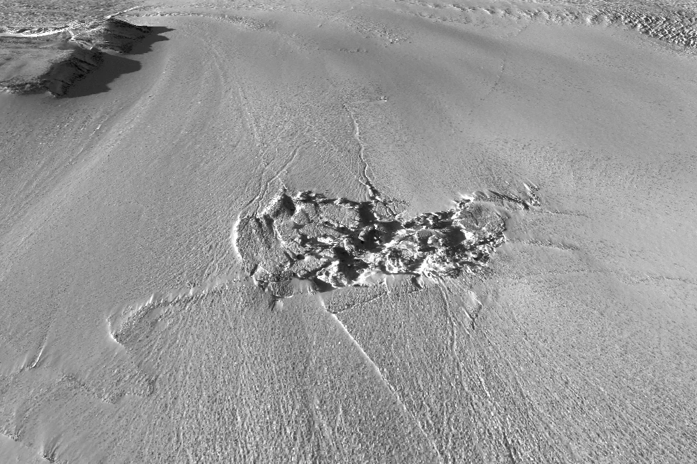
This 3D perspective shows the outburst fracture zone on Greenland's Harder Glacier, based on satellite imagery acquired on April 28, 2015.
These lakes are important because they affect the overall water cycle and ice movement in Greenland. Typically, they form from meltwater on the surface that drains down and gets trapped between the ice and the bedrock. On occasion, they rapidly empty, sending water flowing between the ice and rock, sometimes to the sea and sometimes under glaciers, where they grease the skids and help glaciers flow faster.
These lakes are small, however, so accounting for their impact in models of the Greenland ice sheet has been difficult so far. Increasingly good imagery has enabled researchers to see upwellings or divots in the ice that indicate that a subglacial lake is filling or draining. When looking at this historical data near Harder Glacier, the new studys team noticed a two-square-kilometer area of ice that had collapsed into an 85-meter-deep sinkhole. We dug deeper into it, and what we found, which was even more interesting..., was this fracture zone downstream, which we had totally not expected to see, McMillan says.
Beyond the fracture zone were six square kilometers of smooth ice, wiped clean by a giant deluge. The researchers realized that the collapsed area was a subglacial lake that had rapidly drained. About a kilometer downstream, however, the water hit some kind of obstacle. Instead of flowing down, it pushed up, creating an upheaval of ice blocks and crevasses and what must have been a dramatic gush of 90 million cubic meters of water, or the amount of water that goes over Niagara Falls in nine hours. This all happened within the span of about 10 days.
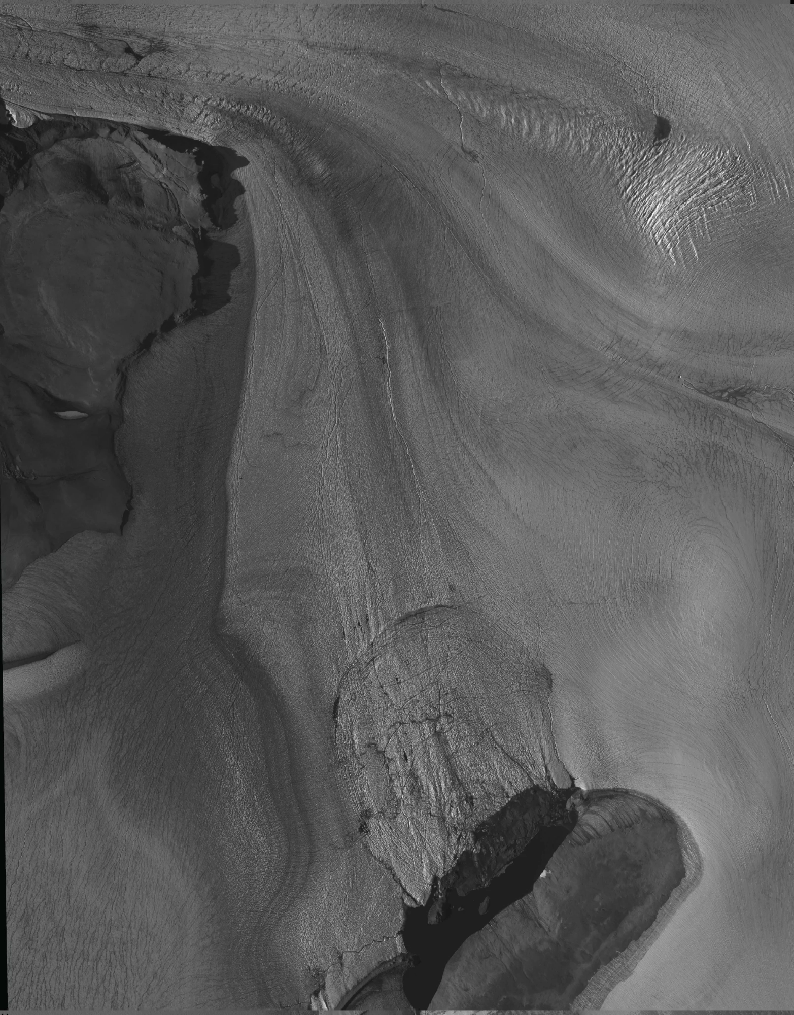
This satellite image shows the subglacial lake region on August 12, 2012, before the subglacial lake drainage and outburst flood occurred.
The water then drained back under the ice sheet and may have ended up beneath Harder Glacier, whichcoincidentally or notsaw a large calving event, in which a chunk of ice plopped into the sea, during that same 10-day period. The glacier also saw unusual changes in its flow rate that summer, suggesting that the flood had an impact on its dynamics, the researchers reported in the new paper.
This is another piece in the puzzle of how big pieces of ice on our planet work, says Robin Bell, a professor of marine and polar geophysics at Columbia Universitys Lamont-Doherty Earth Observatory, who was not involved in the research. The next question is how this puzzle piece fits in with the overall story of Greenlands rapid warming, McMillan says: We need to understand whether this has happened on other occasions.